
- Home
- Services
- Photogrammetry
- DTM / DEM
DTM / DEM
Terrain and surface models with breakline capture and manual editing, not raw correlation output.
DTM / DEM
Automated image correlation produces a dense surface quickly and gets terrain wrong in entirely predictable places: under vegetation, on water, at building edges, in shadow, and anywhere texture is low. Delivering raw correlation output as a terrain model is the most common shortcut in this field.
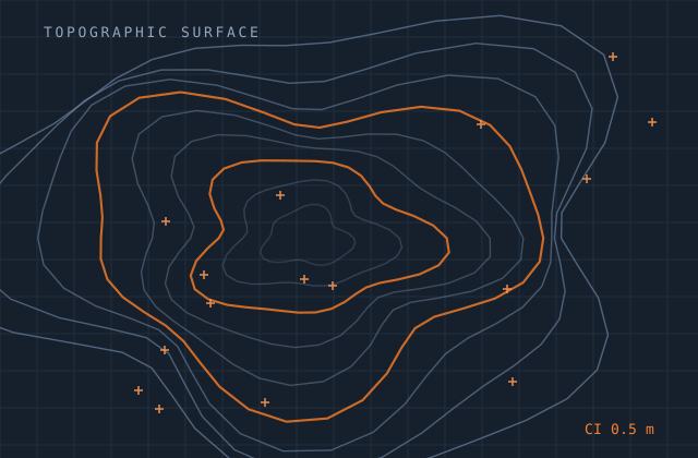
We generate the dense surface and then edit it. Vegetation and structures are removed to produce true bare-earth terrain. Water bodies are flattened and given hydrologically sensible levels. Breaklines are captured where the terrain has genuine discontinuities, so ridges, kerbs and banks survive into the final surface instead of being smoothed away.
Both DTM and DSM are available, and the distinction is maintained rigorously — a DSM that has had some vegetation removed is neither product and is useless for volumetrics or hydrology.
What you receive
Every item below is issued in your own template, with your layer conventions, title block and revision scheme.
- Dense surface generation from stereo image correlation
- Edited bare-earth DTM with vegetation and structures removed
- DSM retaining canopy and built form where required
- Breakline capture at genuine terrain discontinuities
- Water body flattening with hydrologically consistent levels
- Void filling with the method and extent documented
- TIN and grid output at the specified resolution
- Contour generation from the edited surface
- Vertical accuracy report against independent check points
- Hillshade and slope derivatives on request
Production detail
| Typical turnaround | 2–5 weeks by area and edit intensity |
|---|---|
| Grid resolutions | 0.1 m to 30 m as specified |
| Vertical accuracy | Imagery-dependent; typically 0.3–1× GSD in open terrain |
| Editing | Manual bare-earth editing, not raw correlation output |
| Void handling | Interpolated with method and extent documented per void |
| Output formats | GeoTIFF, ASCII grid, LandXML TIN, DWG, LAS, XYZ |
| Revisions | Two rounds included |
Software and formats
We work in your toolchain. If something you use is not listed, ask — the list below is only what we use most.
Frequently asked
Send one dtm / dem job and see how we work
Scope, price and programme come back in writing before anything starts. Most first projects are a single deliverable so you can judge us on output, not on a pitch.