
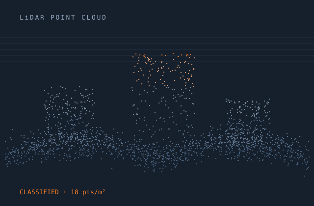
Bare Earth Classification
Bare-earth classification is the most requested LiDAR deliverable and the easiest to get subtly wrong. Automated ground filters do well on open terrain and struggle exactly where accuracy matters most — dense low vegetation, steep slopes, walls and embankments, bridge decks, and the transition between built and natural surfaces.
We run automated classification and then review it systematically in profile, terrain type by terrain type. Ground points wrongly removed from beneath vegetation are recovered; low vegetation, vehicles and temporary structures wrongly retained as ground are removed. Hydro-flattening is applied with water surfaces set at or below their inflow, and breaklines are captured where the terrain demands them.
Vertical accuracy is then verified against control points that were not used in the process, reported per land-cover type because a single aggregate RMSE conceals the categories where the data is weakest.
What you receive
Every item below is issued in your own template, with your layer conventions, title block and revision scheme.
- Classified point cloud — ground, low / medium / high vegetation, building, water, bridge, noise
- Bare-earth ground surface as TIN or grid at the specified resolution
- Hydro-flattened water surfaces with enforced downstream monotonicity
- Breaklines — hydrographic, road, top and bottom of bank
- Contours derived from the conditioned bare-earth surface
- DTM raster at the specified cell size
- Vertical accuracy report against independent control, by land-cover class
- Density, void and overlap consistency analysis
- Tile index and delivery manifest with per-tile QC status
Production detail
| Typical turnaround | 1,000–2,000 km² per month per team |
|---|---|
| Classification standard | ASPRS LAS class codes, or your project schema |
| Vertical accuracy | Verified to project NVA / VVA; typically 5–15 cm RMSEz |
| Point density | 0.5 to 50 pts/m² handled |
| Hydro-flattening | Per USGS LiDAR Base Specification or your equivalent |
| Output formats | LAS 1.2 / 1.4, LAZ, COPC, GeoTIFF, DWG, LandXML, SHP breaklines |
| Revisions | Reprocessed until the specification is met |
Software and formats
We work in your toolchain. If something you use is not listed, ask — the list below is only what we use most.
Frequently asked
Send one bare earth classification job and see how we work
Scope, price and programme come back in writing before anything starts. Most first projects are a single deliverable so you can judge us on output, not on a pitch.